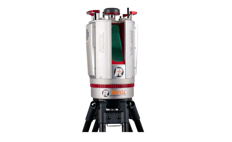
Contact Us: +8610 87513716

The current position:Home >  Hardware  > RIEGL Terrestrial Laser Scanning  > RIEGL VZ-400i
RIEGL VZ-400i
Summary Parameters Video Download
RIEGL VZ-400i
The VZ-400i 3D laser scanning system combines cutting-edge data processing technology, Internet access, MEMS sensors and new scanning technologies.

VZ-400i can process data in real time during scanning, which is achieved through two processing platforms: 

one is a special processing system for fusion system operation, point cloud data and image data synchronization 

acquisition and online waveform processing; The other processing platform can match point clouds, assign coordinates, 

filter data and analyze data in parallel. The VZ-400i internally integrates 3G/4G modem, WiFi,

 and Ethernet communication hardware.


The VZ-400i lidar has a built-in inertial navigation system (MEMS IMU, compass, and barometer) and pulse repetition

 rate of up to 1200 kHz, and can be connected to third-party devices or accessories via USB interface, which greatly

 reduces its usage limitations.


Main characteristics


  • ● Laser transmission frequency up to 1.2MHz
    ● Data measurement speed up to 500,000 points/second
    ● The primary safety laser field Angle is 100° × 360°, which is safe for human eyes
    ● Ranging up to 800 m
    ● Based on echo digitization, real-time waveform processing and multi-wave number transceiver
    Processing techniques are used to measure
    ● New innovative processing module, can be collected data at the same time stitching
  • ● Automatic data splicing
    ● Synchronous collection of point cloud data and image data
    ● Data is transferred to cloud storage devices over LAN, Wi-Fi or 3G/4G
    ● Fully compatible with VMZ hybrid mobile measurement system
    ● Multi-target detection capability
    ● Optional full waveform output module
    ● Attitude estimation bearing sensor
    ● Remote control
    ● Integrated GNSS receiver


Main application


  • ● Completion measurement
    ● Building and facade measurement
    ● Archaeological and cultural heritage documents
    Construction Infrastructure Management (BIM)
    ● Forensics and accident scene investigation


  • ● Urban Modeling
    ● Tunnel measurement
    ● Civil Engineering
    ● Forestry
    ● Research
    ● Monitoring

Hardware
Partners