- Home
- About us
- Hardware
-
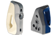 Artec 3D scanner
Artec Eva
Artec Space Spider
Artec Leo
Artec Ray II
Artec Micro
Artec 3D scanner
Artec Eva
Artec Space Spider
Artec Leo
Artec Ray II
Artec Micro
-
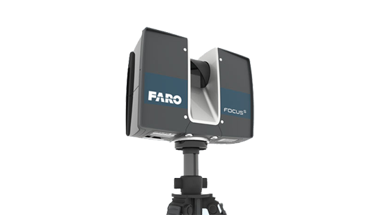 Faro 3D laser scanner
FARO® Focus Premium
FARO FocusM 70
FARO FREESTYLE 2
Faro 3D laser scanner
FARO® Focus Premium
FARO FocusM 70
FARO FREESTYLE 2
-
 Faro industrial reverse scanner
FARO® Quantum Max ScanArms
Quantum Max FaroArm
Faro industrial reverse scanner
FARO® Quantum Max ScanArms
Quantum Max FaroArm
-
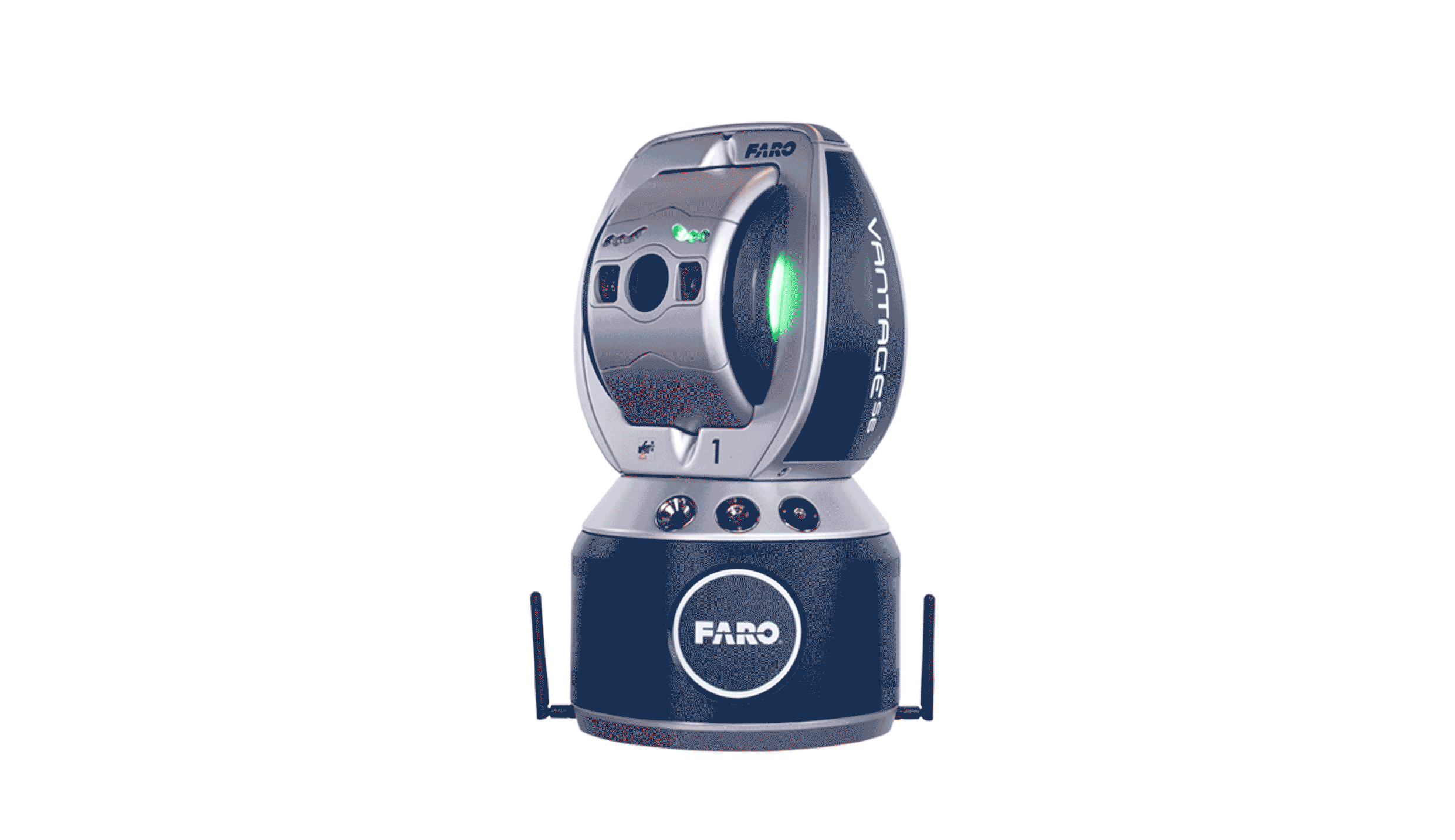 FARO® Vantage Laser Trackers
FARO® Vantage Laser Trackers
FARO® Vantage Laser Trackers
-
 UAV Tilt photography
MS-Smart 2
UAV Tilt photography
MS-Smart 2
-
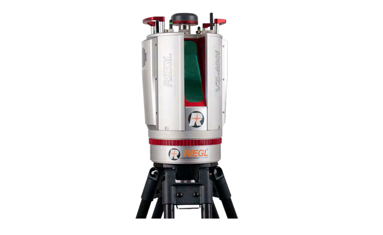 RIEGL Terrestrial Laser Scanning
RIEGL VZ-400i
RIEGL VZ-2000i
RIEGL VZ-4000
RIEGL VZ-6000
RIEGL Terrestrial Laser Scanning
RIEGL VZ-400i
RIEGL VZ-2000i
RIEGL VZ-4000
RIEGL VZ-6000
-
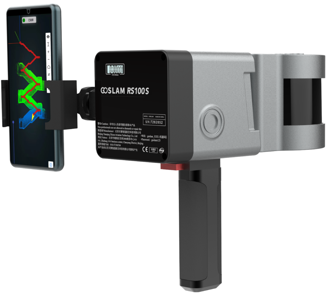 GoSLAM
 VS120
GoSLAM RS100S
GoSLAM RS100i
GoSLAM DS100
GoSLAM RS100
GoSLAM VS100
GoSLAM
GoSLAM VS120
GoSLAM RS100S
GoSLAM RS100i
GoSLAM DS100
GoSLAM RS100
GoSLAM VS100
-
 High resolution aerial camera
Phase One iXU 180
Phase One iXU 150
High resolution aerial camera
Phase One iXU 180
Phase One iXU 150
-
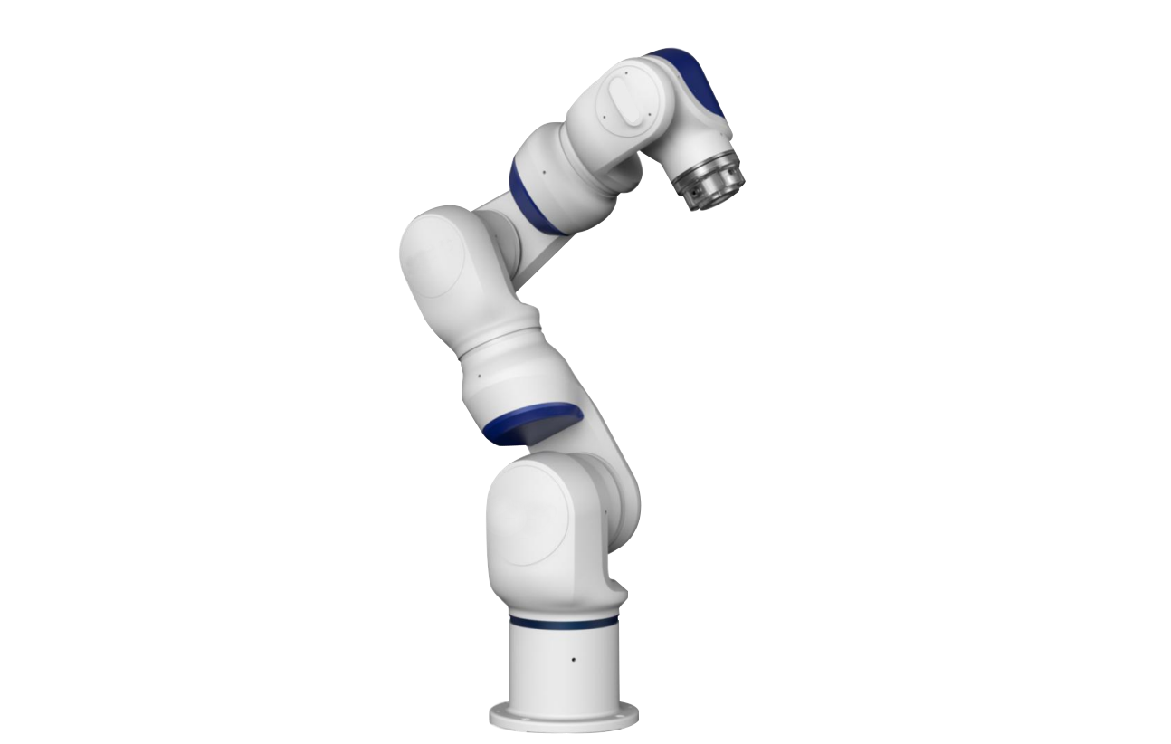 Collaborative robot
Collaborative robot
Collaborative robot
-
 3D Lidar
OS1 Lidar
3D Lidar
OS1 Lidar
-
 3D scanner accessories
标靶球(配准)
棱镜球(配准)
TSP定位装置
3D scanner accessories
标靶球(配准)
棱镜球(配准)
TSP定位装置
-
 ATS positioning registration kit
ATS positioning registration kit
ATS positioning registration kit
-
- Software
-
 Faro software
AS-BUILT FOR AUTOCAD®
AS-BUILT FOR REVIT®
FARO Scene2019
BuildIT Construction
Faro software
AS-BUILT FOR AUTOCAD®
AS-BUILT FOR REVIT®
FARO Scene2019
BuildIT Construction
-
 Clear Edge software
EdgeWise Plant
EdgeWise MEP For Revit
EdgeWise Building
EdgeWise Structure
ClearEdge Verity
Clear Edge software
EdgeWise Plant
EdgeWise MEP For Revit
EdgeWise Building
EdgeWise Structure
ClearEdge Verity
-
 3D Reshaper software
3D Reshaper
3D Reshaper LSDK
3D Reshaper software
3D Reshaper
3D Reshaper LSDK
-
 Arena4D
Arena4D
Arena4D
-
 Artec post-processing software
Artec Studio 14
Artec Studio 15
Artec Studio 17
Artec post-processing software
Artec Studio 14
Artec Studio 15
Artec Studio 17
-
 PhotoScan software
PhotoScan software
PhotoScan software
-
 Onrol products
空间数据浏览器
激光雷达综合应用平台
Onrol products
空间数据浏览器
激光雷达综合应用平台
-
- Application
- Building and engineering City planning Digital City Tunnel engineering Highway acceptance Settlement monitoring Building structure safety inspection Urban disaster analysis Bridge reconstruction railway construction Airport and port
- Cultural heritage protection Ancient architecture protection Site excavation protection Paleontological record Digital Museum
- Geological and scientific applications Terrain Surveying Landslide monitoring Mining operation Forest green quantity
- Electricity and water application Substation Power line inspection Reservoir and dam
- Manufacturing and digital factory Plant facilities Detection and reverse engineering Aviation and shipbuilding
- Public security application Traffic accident Crime scene
- Case
- Cooperation
- Support
- Download
- Train


-

飞思航测相机是为航空摄影领域而专门设计的完整相机系统。
飞思航测相机由业内领先的专家和技术团队开发,不仅从硬件方面确保符合航空摄影使用要求,而且提供多样化的软件方案,无缝衔接整个采集和处理的流程。
飞思航测相机易于安装到现有的飞机和飞行平台,也可以方便的从原有作业系统中升级。飞思航测相机可提供出众的影像质量与比肩传统大型航摄仪的功能。与此同时,飞思航测相机的价格却非常合理。
凭借10款相机,9支镜头,预装系统管理软件的控制器,以及对专业飞控系统和惯导系统的高度兼容。无论是轻型无人机,还是航测大飞机,飞思完整而灵活的航测相机解决方案都可轻松应对。
[����] -

PhotoScan是一款基于影像自动生成高质量三维模型的优秀软件,这对于3D建模需求来说实在是一把利器。
PhotoScan无需设置初始值,无须相机检校,它根据最新的多视图三维重建技术,可对任意照片进行处理,无需控制点,而通过控制点则可以生成真实坐标的三维模型。照片的拍摄位置是任意的,无论是航摄照片还是高分辨率数码相机拍摄的影像都可以使用。整个工作流程无论是影像定向还是三维模型重建过程都是完全自动化的。
PhotoScan可生成高分辨率真正射影像(使用控制点可达5cm精度)及带精细色彩纹理的DEM模型。完全自动化的工作流程,即使非专业人员也可以在一台电脑上处理成百上千张航空影像,生成专业级别的摄影测量数据。
[����] -
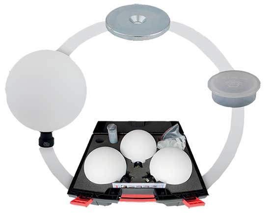
A vital part of Traceable 3D
Traceable 3D quality assures your project over time by establishing repeatable benchmarks that efficiently support data capturing and analysis of 3D point clouds in a traceable and reusable process.
[����] -
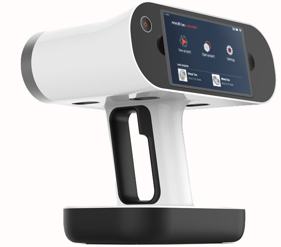 The first 3D scanner to offer onboard automatic processing, Artec Leo is able to provide the most intuitive workflow, making 3D scanning as easy as taking a video. As you scan your object, see the 3D replica being built in real time on Leo’s touch panel screen. Rotate the 3D model, check if you have captured all areas, and fill in any parts you may have missed.[����]
 -
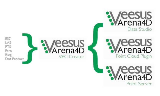 Arena4D is the UK's Ltd Veesus research and development of an innovative 3D point cloud management application software, its technical core is cross platform point cloud rendering engine for viewing and editing the big point cloud data set. As a set of three-dimensional geographic information highly integrated solutions Veesus Arena4D, is the terminal application platform of 3D laser scanning, airborne LiDAR, mobile measurement, UAV tilt photography data acquisition information flow. [����]
 -
-
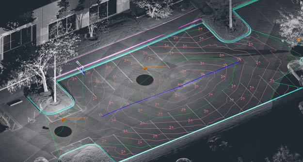
Whether modeling infrastructure design, 2D building planning, industrial and MEP facilities, excavation or calculating orthophotos from point cloud data, As-Built AutoCAD® is up to the task. Equipped with a set of easy-to-operate features, it extends the point cloud capabilities of the original AutoCAD® with a versatile utility for point cloud processing.
[����] -
-
-

- Faro software
- Clear Edge software
- 3D Reshaper software
- Arena4D
- Artec post-processing software
- PhotoScan software
- Onrol products