


|
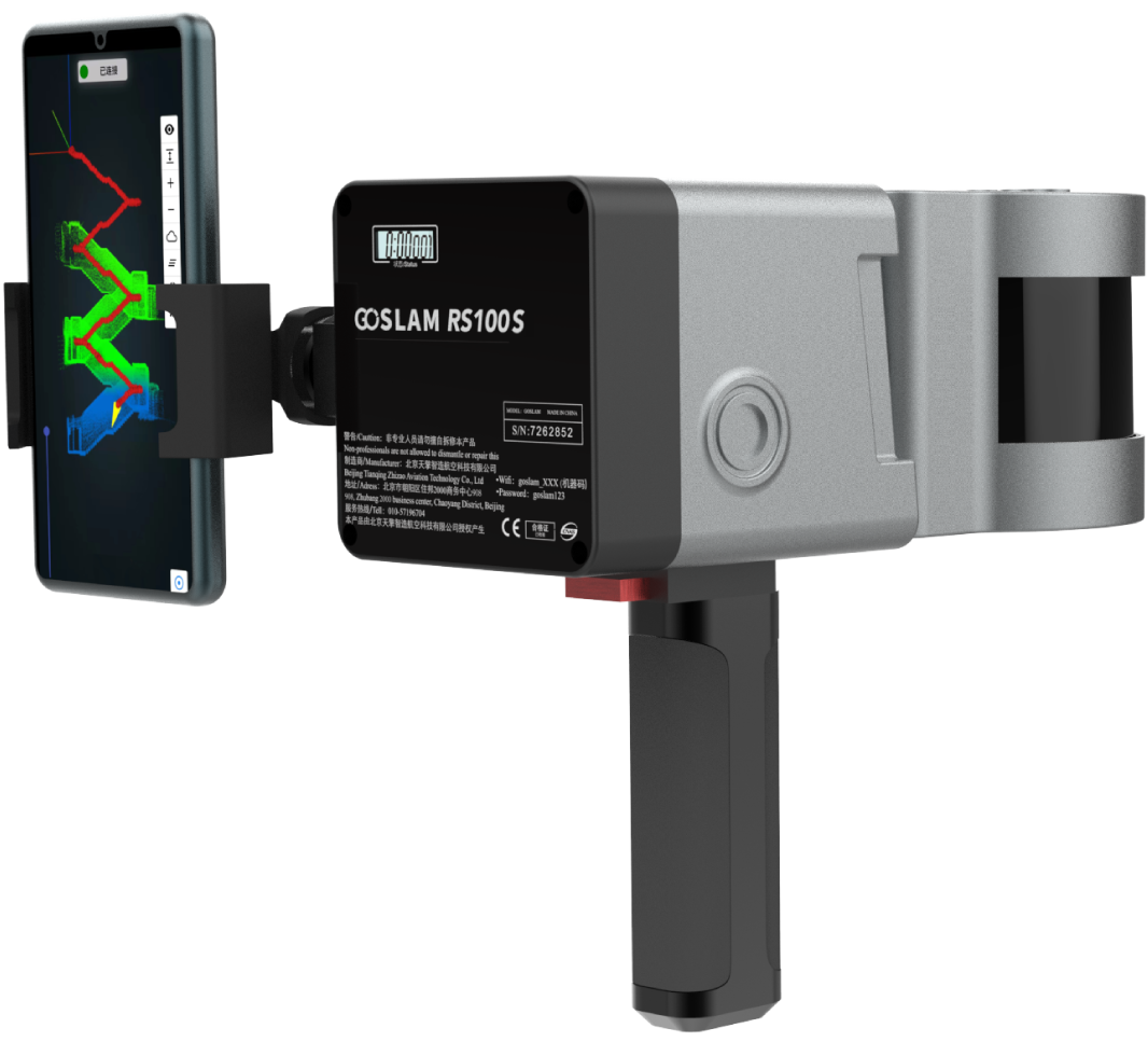
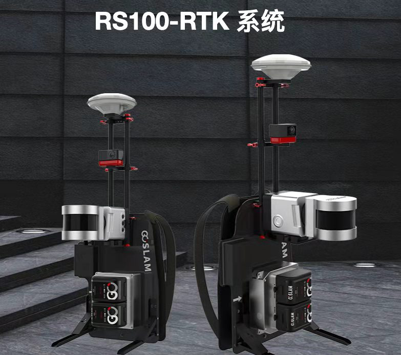
GoSLAM RS100-RTK SYSTEM
a new way to measure mobile
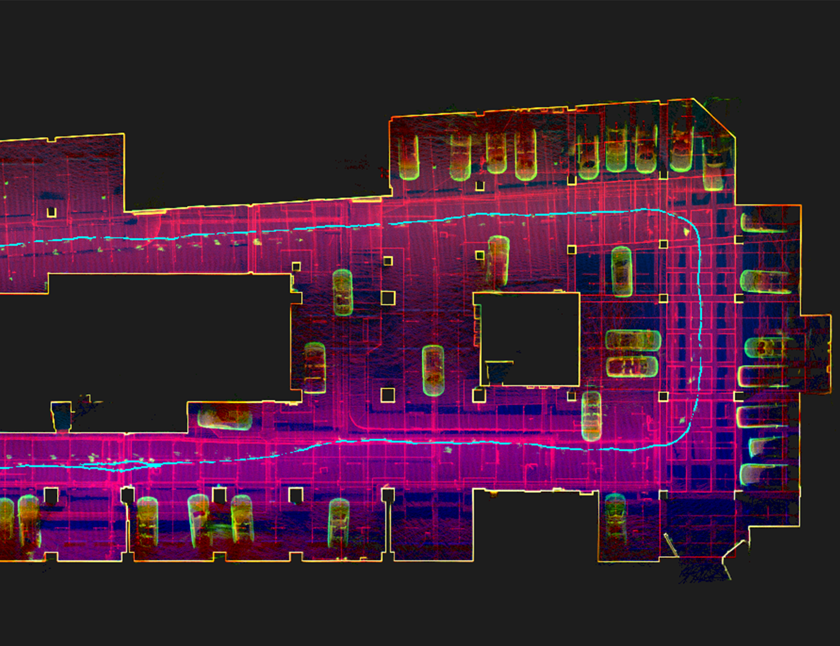
GoSLAM RS100-RTK mobile measurement system integrates SLAM (simultaneous localization and mapping), that is, real-time positioning and mapping technology with RTK (Real - time kinematic) centimeter-level satellite differential technology, which can not rely on GNSS positioning such as GPS, and scan and build maps in unknown environments such as indoor and outdoor space. It can also be used in an open outdoor environment to use the differential positioning system for positioning assistance, directly correct the accumulated error, so that the whole system can obtain more accurate point cloud data without closing the loop in the large-scale outdoor acquisition process. GoSLAM is committed to providing customers with mobile 3D laser measurement system product solutions with better user experience. GoSLAM RS100-RTK mobile measurement system integrates SLAM (simultaneous localization and mapping), that is, real-time positioning and mapping technology with RTK (Real - time kinematic) centimeter-level satellite differential technology, which can not rely on GNSS positioning such as GPS, and scan and build maps in unknown environments such as indoor and outdoor space. It can also be used in an open outdoor environment to use the differential positioning system for positioning assistance,directly correct the accumulated error, so that the whole system can obtain more accurate point cloud data without closing the loop in the large-scale outdoor acquisition process. GoSLAM is committed to providing customers with mobile 3D laser measurement system product solutions with better user experience. |
|
mixed solutions, export ready to use
centimeter-level real-time positioning, no need to close the loop
18 million panoramic collection and enrichment of point cloud information
long distance, high frequency
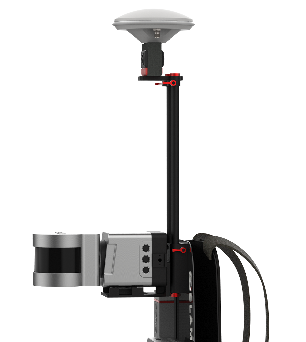
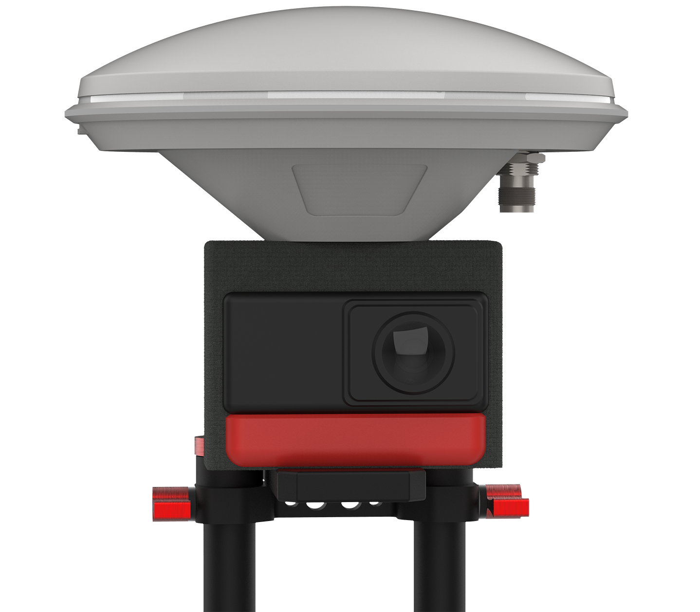
RTK differential
with centimeter-level positioning accuracy, it provides real-time accurate positioning for the slam system, corrects the stitching error at any time, and makes the slam system clear and accurate position at any time, without the need for a closed-loop path
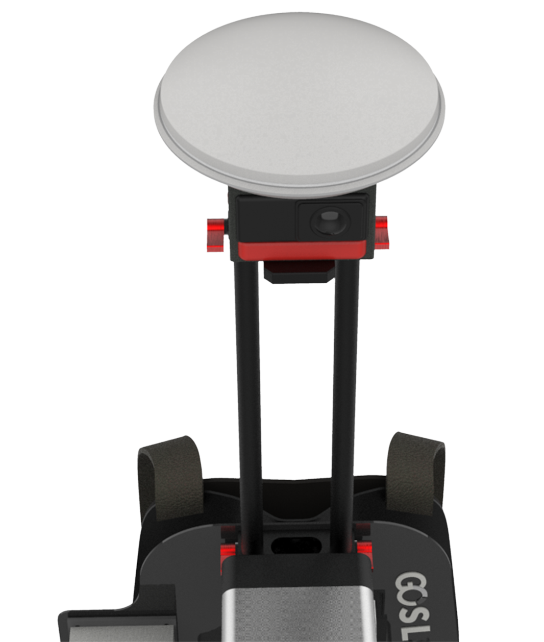
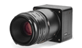
panoramic camera
the 18-megapixel panoramic camera collects the images we need at any time, matches the point clouds, makes the data more realistic, allows us to retain more on-site information through the data, and makes the data more practical
hybrid solving techniques
the product has a unique hybrid solving technology to ensure higher accuracy, improve its own solving speed, and greatly improve the scanning efficiency
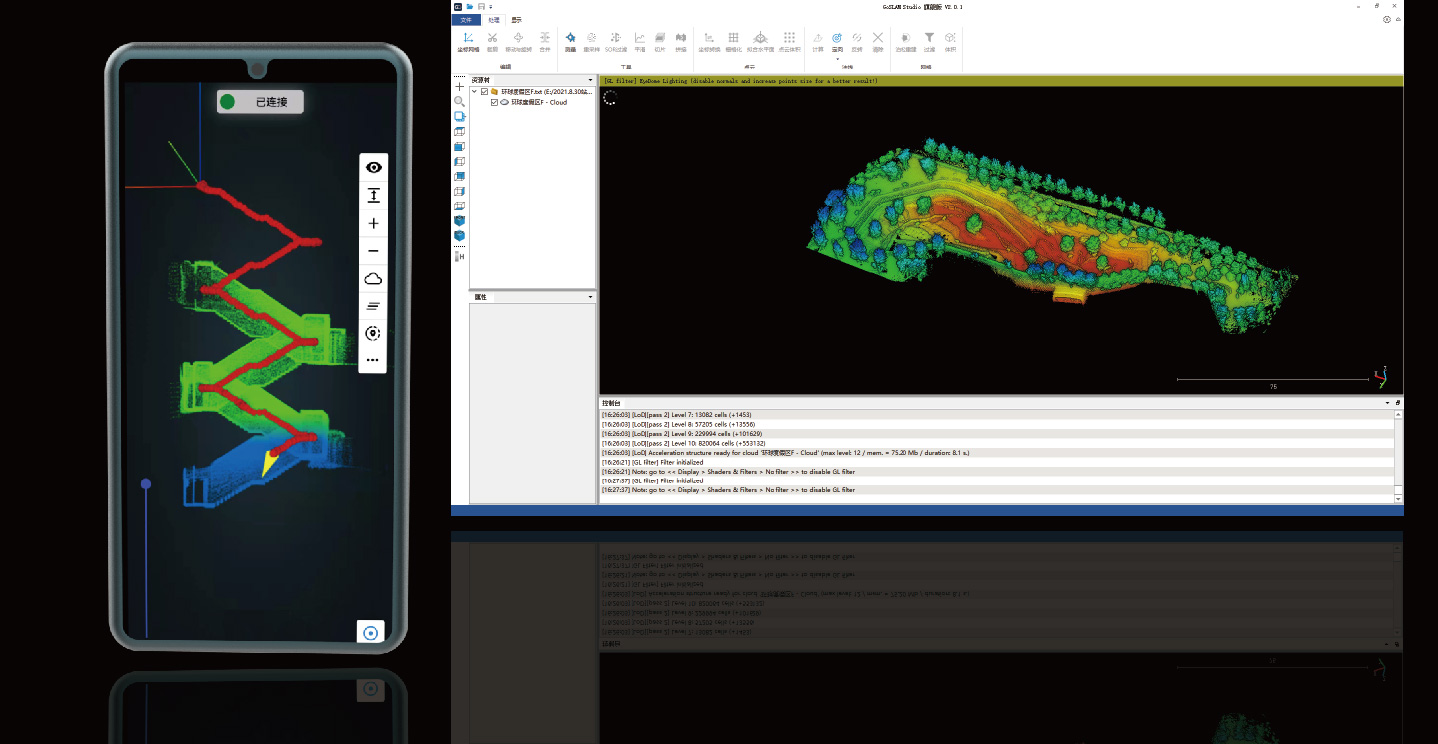
standard post-processing application process
GoSLAM Studio Ultimate Software is a companion software specially designed and developed for the GoSLAM series of mobile 3D scanners that integrates device applications and point cloud processing, and is also compatible with third-party device point cloud processing.
The software has eight basic functions: one-click point cloud denoising, point cloud stitching, shadow rendering, coordinate conversion, automatic fitting of horizontal planes, automatic generation of point cloud data reports, orthographic photography, and point cloud encapsulation. GoSLAM adds a one-click stack data generation function for stack volume metering, making data acquisition more convenient.